Theory is a result of practical observation. Technology is a tool for observation. We run the survey process and implement the technology for the practical observations. Geo-informatics is the tool for practical environmental studies. It does not only beverage the scoop of geo-informatics technology but also accelerate the environmental understanding. We represent our products for the following traits.
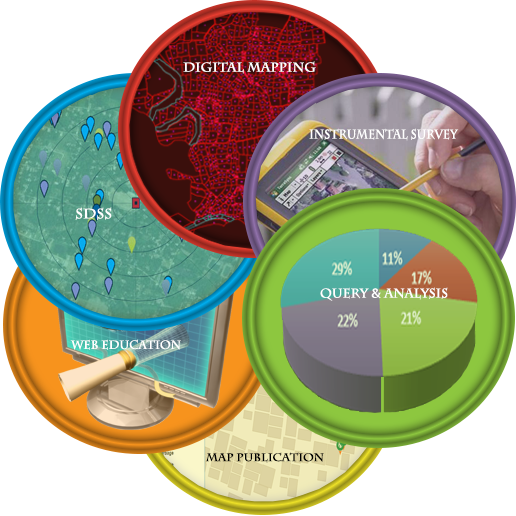
 Digital Mapping
Irrespective of satellite imageries on the background the application is enable to draw the vectors online and also offline.
 Instrumental Survey
Special and customized application tools are provided to collect the perfect spatio-temporal information for our environment.
 Query and analysis
The product is built to harness specific information regarding the geographical and environmental elements of the map base. The product is enabled to make predefine queries and analysis techniques.
 Map Publication
The real time data base of geographical and environmental elements are served through the application channels to the common or authorized people for their specific purposes.

The land base vector is prepared with the help of particular imagery provided in our web based application.The work on base map may be done online and offline also.

The survey tools are specially customized to collect geographical and environmental data and directly transmit to and retrieve form the server.This is a conjugated part of instrumentation and survey.

The vectors of environmental elements are represented along with the geographical data to show the pattern of existence.The map pertaining to the environmental data is enabled for certain types of analysis.

The navigation map is featured with rich real-time road networks and POI data.Our unique navigation map is enabled with special features of day by day utilities.

The activity map is a portrait of task schedule completed by the user of this application for the social and technological works.This activity map not only keeps the record of events but also promotes the healthy competitions among the users for improving the technological growth and the social well-being.

The mathematical indexing is done with the help of real time data and automated tools.The users will be able to prepare the status of cleanliness in terms of index value.This will represent the comparative situation of environmental improvement.
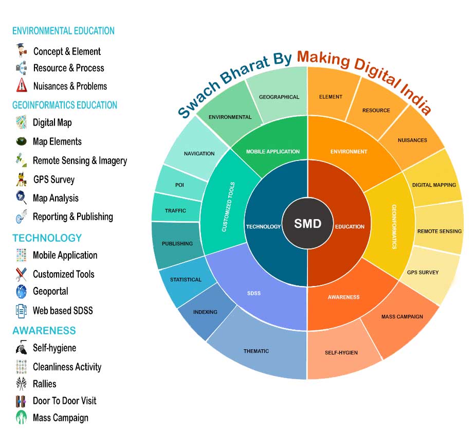
Technology is the assembly and application of techniques to see and work on the technical traits. You need to enter into our geo-spatial world.

Concept builders contribute to building the blue print of the project,preparing SOP and analytical improvements.The esteemed director the main concept builder of this programme.

The development section always contributed for designing and developing the product with the help of latest technology.They are also engaged in maintaining the dynamism of the entire work affair.

The technical and the social implementers are the main activists on the implementation side.They are engaged in data processing,surveying,training and consulting the work affairs of the programme.
The programme is initially called Swatch Bharat by making Digital India.It is a socio-technical programme for the peoples.
From the technological view point it is the matter of technological application. On the other hand it is a social awareness programme.
This is the multipurpose programme.This programme serves the purposes of educating students,promoting technologies,building social ethics and making social awareness.
Geomaticx app is a mobile application for environmental monitoring and reporting system.
The common language for the instruction, monitoring, reporting and awareness is English but we have a provision of Bengali.
Students,Educators,Technologists are the main participants of this programme.General people and the Govt. authorities may contribute in this programme.
Geomaticx map is the geo-spatial application for digital mapping and digital environment.
The interested developers, geo-specialists, educators, technologists, social-activists and corporates can apply for and contribute to the programme.
Scholars and qualified persons who contributed actively in the Geoinformatics and Environmental Sustainability project are as follows:
The external contributors are freely invited to be associated in the programme in the ways defined below:

Sandip Maiti, Technology Provider,Implementer"Digital mapping and spatial information system integration is a latest trend in the application section of IT and ITES in the day to day livelihood. The Geo-spatial applications are not only limited to the social utilities but also solving the spatio-temporal problems of the society. The concerned application as well as the concept is a remedial approach towards recognizing, monitoring and preventing the possible misuse of resources, unethical behaviour of people and developing good social practices for the entire social wellbeing. Further the concept and the application is a portray of the Clean India and Digital India mission and the innovative implementation agenda of Geo-informatics at the grass-root level."

Prof. Atish Dipankar Jana, Technological & Educational Adviser"The technology of Geo-informatics is an integrated discipline of Applied Geography and Information Technology. Though the concerned technology does not only justify the application of their mother disciplines but also justify the theory and the information of other disciplines in the spatio-temporal context. As a result, this synthetic discipline has been planned to be utilized to intensively monitor the delicate environmental elements and activities at the micro level. From the viewpoint of technological traits and acceptability of environmental studies even at the school level it deserves a great significant for diffusing the technology as well as making social awareness through environmental education."

Sanjib Kumar Maiti, Social Organizer"The aim of the application of any technology is to fulfil the social goal. Any concept may be diffused through publication and publicity. So publication and publicity have been the integrated agenda of the concerned programme to be popular and effective in the general people. In terms of reaching the social welfare with respect to improve the social behaviour and practices of common people, the programme has a great significance even from the micro level to the national level. On launching and implementing the application as well as the concept, we are extremely confident that the programme will serve the multipurpose aims for improving the environmental status of the society as well as the technical knowledges of the student communities."